Top 50 Free Places To Visit in Los Angeles: Free in LA
Now Go See It is reader-supported. When you buy through links on our site, we may earn an affiliate commission.
From iconic sights to offbeat neighborhoods, there’s no shortage of free things to do in Los Angeles. This list is full of ways to explore LA for free.

Griffith Observatory
Map: Google Maps
Website: Link
Come for the planetarium and views, stay for the chance to feel like you're in every movie ever set in LA. Admission to the exhibits is free, and you can look through telescopes after dark on clear nights. The hike up to the observatory adds some exercise to your sightseeing if you’re up for it.

Hollywood Walk of Fame
Map: Google Maps
Website: Link
This isn’t subtle or hidden—but it’s still worth doing. Stretching for blocks along Hollywood Boulevard, the Walk of Fame mixes historic landmarks with kitsch. You’ll pass old theaters, street performers, and about a thousand stars you forgot were famous. Read our half-day Hollywood Blvd Itinerary.

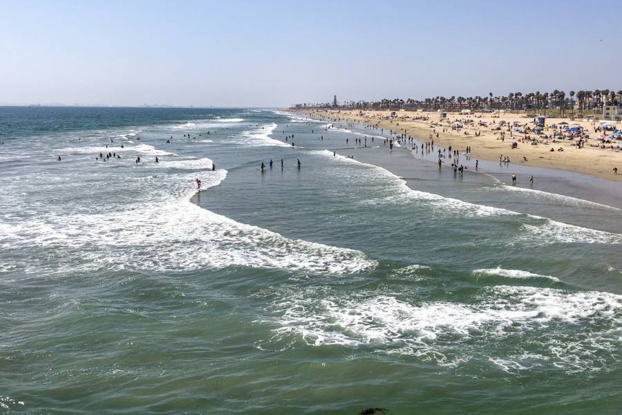
Santa Monica Pier
Map: Google Maps
Website: Link
Yes, it’s touristy. But the view from the pier—especially at sunset—makes up for it. You don’t have to spend a cent to enjoy the beach, watch the skate park, listen to live music, or walk out over the water and spot surfers below.
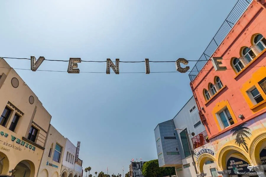
Venice Beach Boardwalk
Map: Google Maps
You’ll get a crash course in LA weirdness here. From skateboarding dogs to tarot readers, this is prime people-watching territory. Murals, Muscle Beach, and the ocean breeze round it out.
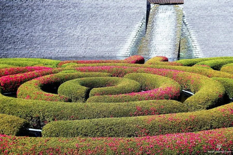
The Getty Center
Map: Google Maps
Website: Link
It’s free to get in, and the views are enough to make the trip worth it even if you skip the art. The museum has an impressive collection of European paintings, sculpture, and decorative arts. You’ll also ride a short tram up the hill to get there, which is part of the fun. Parking is not free.

The Broad
Map: Google Maps
Website: Link
Downtown’s modern art showpiece doesn’t charge admission, but you’ll want to make a free reservation online. The building itself is as photogenic as the art inside. If you’re lucky, you might even score access to Yayoi Kusama’s Infinity Mirror Room.

Griffith Park
Map: Google Maps
Website: Link
One of the largest urban parks in the country, Griffith Park has hiking trails, picnic spots, and even an old abandoned zoo you can walk through. It’s also where you’ll find the Greek Theatre, the Autry Museum, and the aforementioned Griffith Observatory. You could spend a whole day here and not repeat anything.

Bradbury Building
Map: Google Maps
Website: Link
Downtown LA's most famous interior is open to the public on the first floor. This 1893 office building looks like something out of Blade Runner or a steampunk graphic novel. Come for the ironwork and natural light; stay for the echoing footsteps and old elevator cages.

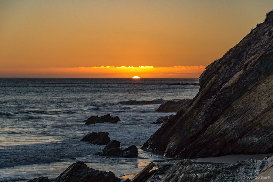
El Matador Beach
Map: Google Maps
Website: Link
It’s technically in Malibu, but close enough. Free parking is limited, so come early or be ready to walk. You’ll head down a steep trail to a small beach with rock formations that photographers love—especially at low tide.

Bee Rock Overlook
Map: Google Maps
Map: AllTrails
Located in Griffith Park, Bee Rock is a short but steep hike that leads to a fenced overlook above the old LA Zoo. The rocky outcrop gives you wide views of the park and the city below without the crowds you’ll find at the Observatory trails. The trailhead starts near the carousel, and you’ll pass by some interesting abandoned animal enclosures on the way up. It’s a great option if you want something scenic that still feels a little off the usual tourist route.

Kenneth Hahn State Recreation Area
Map: Google Maps
Website: Link
This sprawling park in Baldwin Hills flies under the radar but offers city skyline views, grassy hills, and duck ponds. There are several hiking trails and a Japanese garden tucked into the center. Entry is free on weekdays if you walk in or park on the street nearby.
Sepulveda Basin Wildlife Reserve
Map: Google Maps
Website: Link
Tucked away in the San Fernando Valley, this quiet section of the Sepulveda Basin is full of trails, native plants, and birdwatching spots. It’s not flashy, but you’ll see egrets, herons, ducks, and maybe even a hawk if you’re lucky. There’s a short loop trail with benches and shaded areas, and it feels far removed from the freeway traffic just outside. You can access it from Woodley Park, and parking is free.

Grand Park
Map: Google Maps
Website: Link
Stretching from the Music Center to City Hall, Grand Park is a solid downtown stop for people-watching, pop-up art, and quick breaks between sightseeing. The fountain at the top of the hill doubles as a splash pad for kids in warmer months. It’s surrounded by civic buildings and usually hosts free events, cultural festivals, and outdoor concerts. You can walk straight through or sit under the pink chairs and watch LA go by.
North Hollywood Amelia Earhart Statue and Park
Map: Google Maps
Website: Link
This small park in NoHo is home to a statue of Amelia Earhart, who once lived nearby. There’s a small rose garden and plenty of open space for relaxing or walking around. The surrounding neighborhood has lots of murals, so it’s worth exploring on foot.

Arts District Murals Walk
Map: Google Maps
Website: Link
Downtown’s Arts District is a mural hotspot, and walking through it is like an outdoor gallery tour. Start near 3rd and Traction and make your way east past bold graphics, massive portraits, and abstract street art. It’s free, constantly changing, and makes for great photos.
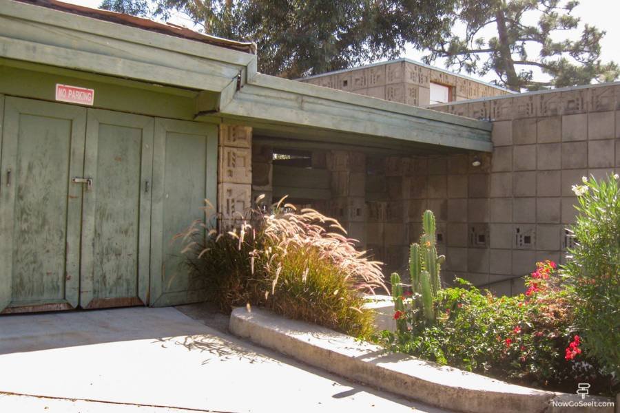
Eames House (Exterior View)
Map: Google Maps
Website: Link
The famous Case Study House #8 by Charles and Ray Eames is in Pacific Palisades. While you can’t go inside without a reservation and ticket, viewing the exterior from the walking path on the bluff is free. It’s a pilgrimage spot for architecture lovers.

Exposition Park Rose Garden
Map: Google Maps
Website: Link
Across from the Natural History Museum, this garden blooms most of the year and is open to the public for free. There are hundreds of varieties of roses arranged around a central fountain. Benches line the paths, and it’s easy to pair with a visit to nearby museums.

Airline Miles and Hotel Points 101
We share tips and tricks for credit card points and miles. These tools help us save money on our trips around the world by allowing us to accumulate airline and hotel points.

LACMA Urban Light
Map: Google Maps
Website: Link
Even if you skip the museum, the iconic Urban Light installation by Chris Burden is worth a stop. It’s just outside the entrance and always full of people taking photos. At night, the lamps are turned on, and it looks even better.

The Last Bookstore
Map: Google Maps
Website: Link
It’s a functioning bookstore, but you can easily treat it like a museum. The layout is bizarre—in a good way—with books turned into tunnels and sculptures. It’s free to browse, and you’ll find everything from vintage maps to sci-fi paperbacks.

Runyon Canyon
Map: Google Maps
If you want a short hike with a high celebrity sighting potential, this is your spot. The main trail is a loop with steep and moderate sections, and dogs are everywhere. Views of the Hollywood Sign and downtown are built-in bonuses. Read our Runyon Canyon Guide here.

La Brea Tar Pits (Outdoor Grounds)
Map: Google Maps
Website: Link
While the museum charges admission, walking around the bubbling tar pits and outdoor sculptures is totally free. You’ll see life-size fiberglass mammoths, methane gas escaping from puddles, and scientists working behind glass in the fossil lab. The park area also has signage explaining the history and excavation process, so you’ll still learn something without going inside. It’s an odd combination of prehistoric science and public park space right in the middle of the city.

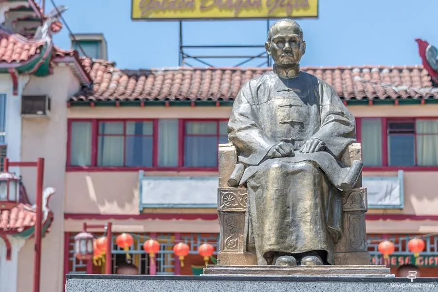
Chinatown Central Plaza
Map: Google Maps
Website: Link
This pedestrian plaza feels like a movie set and is often used as one. Explore the neon signs, mini temples, and local shops. Grab a mooncake or just wander around and look for murals and hidden corners.
The Music Box Steps
Map: Google Maps
In Silver Lake, you’ll find one of LA’s strangest historic landmarks—an outdoor staircase made famous by the 1932 Laurel and Hardy short film The Music Box. The steep steps run between Vendome Street and Descanso Drive and are open to the public at all times. It’s a quick stop, but if you’re into film history or just looking for an offbeat photo spot, this one delivers. The surrounding neighborhood is walkable and full of interesting architecture.

Los Angeles Central Library
Map: Google Maps
Website: Link
Right in the middle of downtown, the LA Central Library is an architectural standout. The original 1920s building has murals and tiled ceilings, and there’s usually a rotating exhibit near the lobby. Head upstairs to check out the dome.

Echo Park Lake
Map: Google Maps
You can rent swan boats if you want, but walking the perimeter path is free and takes about 20 minutes. Downtown LA reflects off the lake, and there are lotus flowers in bloom most of the year. It’s a nice escape from the traffic without going far.

Hollywood Forever Cemetery
Map: Google Maps
Website: Link
You’re allowed to walk through during regular hours, and it’s not as creepy as it sounds. This is the final resting place of Rudolph Valentino, Judy Garland, and other LA icons. Some tombstones are elaborate, and the view across the lake is surprisingly peaceful.

Baldwin Hills Scenic Overlook
Map: Google Maps
Website: Link
This is the one with the steep stairs you’ve probably seen on Instagram. You’ll climb 282 concrete steps straight up to a view of LA that stretches from the ocean to downtown. It’s a workout, but there’s also a regular trail if you prefer to zigzag.

Point Dume
Map: Google Maps
Website: Link
Drive past the main Malibu beaches to find this quieter stretch of coast. Free parking is limited but worth the gamble. You can hike up a short path to a blufftop with panoramic views and maybe spot dolphins or whales in the distance.

Murphy Ranch Ruins
Map: Google Maps
In the hills above Pacific Palisades, this strange hike leads to abandoned staircases and graffiti-covered buildings that were once part of a 1930s Nazi sympathizer compound. It’s a bizarre piece of LA history you’ll need good shoes to explore. Not exactly scenic, but definitely unforgettable.
Los Angeles State Historic Park
Map: Google Maps
Website: Link
Right near Chinatown, this park has wide open lawns, walking paths, and an occasional pop-up event. Trains still run along the edge of the site, and downtown views make it good for quick photo stops. If you're walking from Union Station, it’s only about ten minutes.
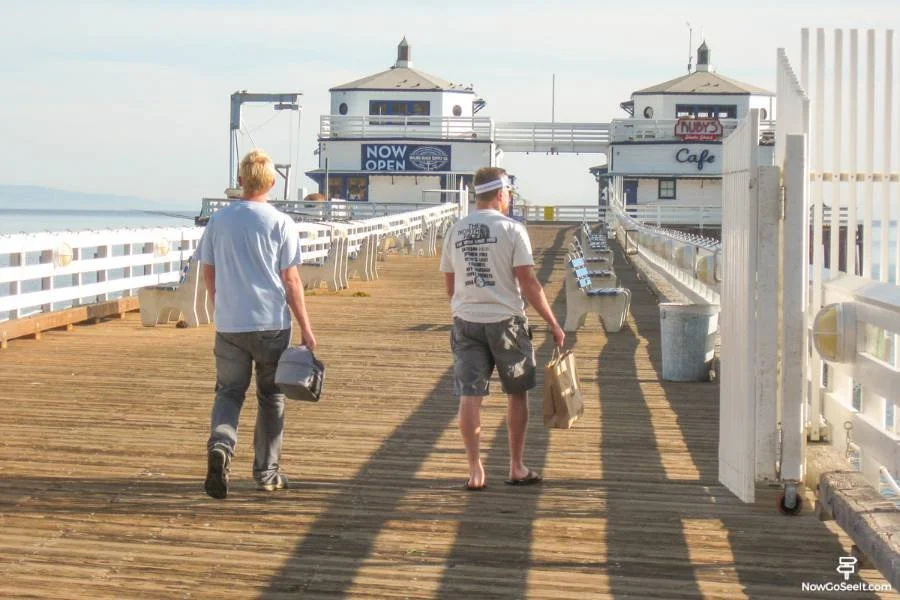
Malibu Pier
Map: Google Maps
Website: Link
The pier is open to the public and offers classic Southern California views without the chaos of Santa Monica. Watch surfers, spot birds, and maybe catch someone fishing. There’s no charge to walk the length of it.

Greystone Mansion Grounds
Map: Google Maps
Website: Link
The gardens and exterior of this old Beverly Hills mansion are free to explore when the gates are open. You’ll recognize the staircase and courtyard from dozens of movies. There’s no interior access, but the views over the city are good and the landscaping is manicured.
Los Feliz Blvd & Vermont
Map: Google Maps
This intersection is walkable and loaded with vintage shops, coffee spots, and a handful of small theaters. It’s a good neighborhood to explore without needing a set plan. Walk uphill and you’ll end up near Griffith Park.
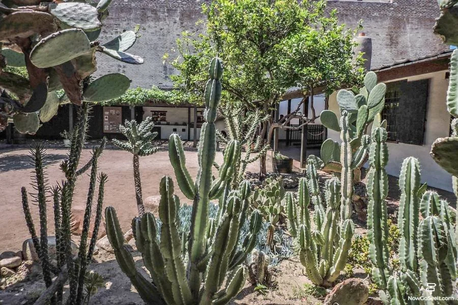
El Pueblo de Los Angeles
Map: Google Maps
Website: Link
This historic district around Olvera Street is technically the birthplace of LA. Browse free exhibits in the plaza, listen to mariachi bands, and watch traditional dance performances. There are also tiny museums and the city’s oldest house.
Third Street Promenade
Map: Google Maps
Window shopping on the promenade doesn’t cost anything, and there’s usually something weird going on—like a full band playing outside an Apple store. Street performers, public art, and ocean air make this an easy place to kill some time.

Franklin Canyon Park
Map: Google Maps
Website: Link
This park between Beverly Hills and the Valley feels more remote than it is. There’s a small lake, a duck pond, and lots of shade. Some of the trails have been used in movies, especially 1950s westerns and TV shows.

Ballona Creek Bike Path
Map: Google Maps
If you have a bike or feel like a long walk, this path runs from Culver City to Marina del Rey. It’s not scenic in the traditional sense, but there’s good birdwatching and urban landscape photography potential.
Check out our other posts about things to see and do in CITY or COUNTRY!
Or visit our Destinations page to be inspired.

Yamashiro Gardens (Public Access Area)
Map: Google Maps
Website: Link
Above Hollywood Boulevard, the grounds around Yamashiro Restaurant are open to the public during the day, even if you’re not dining there. The small Japanese-style garden has koi ponds, stone lanterns, and a quiet walking path with sweeping views of Los Angeles. You can also catch a close-up look at the historic Yamashiro estate, originally built in 1914. It’s free to visit the gardens—just enter through the side driveway and let the valet know you’re walking through.

Topanga State Park
Map: Google Maps
Website: Link
It’s free to enter on foot—only parking costs money. Once inside, you’ll have access to more than 30 miles of trails through the Santa Monica Mountains. There’s chaparral, canyon views, and the occasional lizard that’s entirely too friendly.
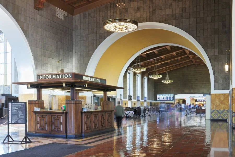
Union Station
Map: Google Maps
Website: Link
You don’t need a ticket to walk through LA’s main train terminal. The Spanish Revival architecture, tile work, and waiting areas feel like a throwback to the 1930s. It’s air conditioned and full of photo ops.

Marina Beach (Mother’s Beach)
Map: Google Maps
Website: Link
This little cove in Marina del Rey is calm and quiet compared to the open coast. There’s no surf, which makes it a good low-key beach for relaxing. You’ll also get views of the yachts going by.

Tongva Park
Map: Google Maps
Website: Link
This modern park near the Santa Monica Pier has winding paths, lookout points, and sculptures. It’s rarely crowded and feels designed for walking in loops. The playground area is especially popular with families.
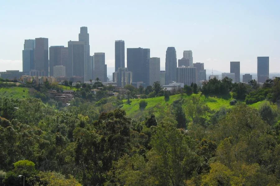
Angel’s Point in Elysian Park
Map: Google Maps
Website: Link
This isn’t the most famous overlook, but it’s one of the quietest. Drive or walk to the top, and you’ll get views of downtown LA framed by eucalyptus. It’s a good picnic spot if you remembered to bring snacks.
Vista Hermosa Natural Park
Map: Google Maps
Website: Link
This small park east of downtown has benches facing the skyline and a little loop trail. There’s a picnic area and a few shady spots to hang out. It’s usually not crowded, even on weekends.

Little Tokyo Plaza
Map: Google Maps
Website: Link
You’ll find free art installations and pop-ups scattered throughout the neighborhood. Some stores even have small galleries inside. The Japanese American National Museum charges admission, but often hosts free cultural events in the plaza outside.

We’re on YouTube!
The same great content without all the pesky reading!
Los Angeles River Greenway Trail – Studio City Section
Map: Google Maps
This lesser-known stretch of the LA River runs behind buildings in Studio City between Whitsett and Coldwater Canyon. It’s been landscaped with native plants, benches, and interpretive signs, making it feel more like a community nature walk than an urban drainage channel. You’ll see murals, birds, and maybe a turtle sunning itself along the restored wetlands. It’s a quiet, walkable escape tucked behind Ventura Boulevard that most people drive past without knowing it’s there.
Chavez Ravine Arboretum
Map: Google Maps
Inside Elysian Park—just a short walk from Dodger Stadium—you’ll find one of the oldest arboretums in the western United States. Established in 1893, the Chavez Ravine Arboretum features over 100 species of trees from around the world, including rare and exotic varieties you won’t see elsewhere in LA. It's completely free to walk through, and there are signs identifying many of the trees. You don’t need to be a plant expert to enjoy it—just bring comfortable shoes and a little curiosity.

Palisades Park
Map: Google Maps
Website: Link
This clifftop park runs parallel to Ocean Avenue in Santa Monica and has some of the best coastline views in LA. It’s a popular walking route, especially in the evening. Bring a camera or just look out over the beach and relax.

Travel Town Museum
Map: Google Maps
Website: Link
In Griffith Park, this open-air museum is full of old trains and railcars you can explore for free. It’s aimed at families, but train lovers of any age will find something to like. Open daily with no admission fee.

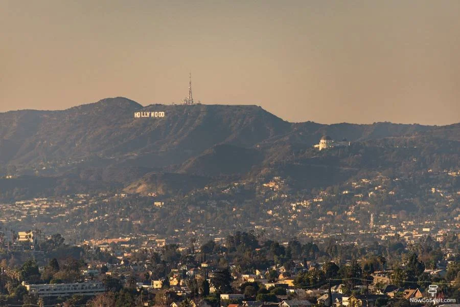
Hollywood Reservoir (Lake Hollywood Loop)
Map: Google Maps
Just below the Hollywood Sign, the paved loop trail around the Hollywood Reservoir offers some of the best skyline-to-sign views without the steep climb. The full loop is about 3.3 miles and stays relatively flat, with shaded sections, lake overlooks, and photo spots along the Mulholland Dam. You can park for free on nearby streets and walk right in. It’s a peaceful break from the chaos of nearby tourist spots, and you’ll still leave with an iconic view or two.


Free Things To Do in Los Angeles:
Griffith Observatory
Hollywood Walk of Fame
Santa Monica Pier
Venice Beach Boardwalk
The Getty Center
The Broad
Griffith Park
Bradbury Building
El Matador Beach
Bee Rock Overlook
Kenneth Hahn State Recreation Area
Sepulveda Basin Wildlife Reserve
Grand Park
North Hollywood Amelia Earhart Statue and Park
Arts District Murals Walk
Eames House (Exterior View)
Exposition Park Rose Garden
LACMA Urban Light
The Last Bookstore
Runyon Canyon
La Brea Tar Pits (Outdoor Grounds)
Chinatown Central Plaza
The Music Box Steps
Los Angeles Central Library
Echo Park Lake
Hollywood Forever Cemetery
Baldwin Hills Scenic Overlook
Point Dume
Murphy Ranch Ruins
Los Angeles State Historic Park
Malibu Pier
Greystone Mansion Grounds
Los Feliz Blvd & Vermont
El Pueblo de Los Angeles
Third Street Promenade
Franklin Canyon Park
Ballona Creek Bike Path
Yamashiro Gardens (Public Access Area)
Topanga State Park
Union Station
Marina Beach (Mother’s Beach)
Tongva Park
Angel’s Point in Elysian Park
Vista Hermosa Natural Park
Little Tokyo Plaza
Los Angeles River Greenway Trail – Studio City Section
Chavez Ravine Arboretum
Palisades Park
Travel Town Museum
Hollywood Reservoir (Lake Hollywood Loop)